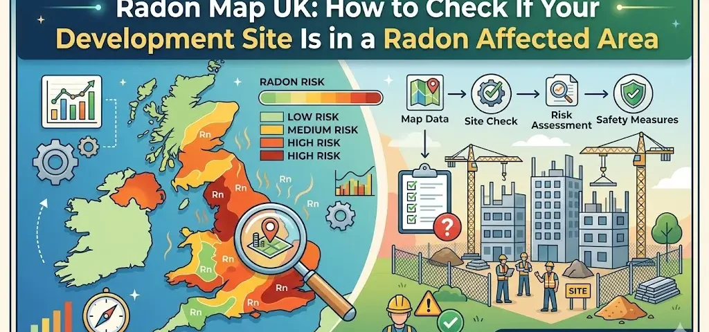
Radon causes an estimated 1,100 lung cancer deaths in the UK every year. It is invisible, odourless, and entirely undetectable without testing. And for any developer building in a radon affected area, checking the UK radon map is not optional. It is one of the first due diligence steps that determines what your building design must include, what Building Regulations require, and what planning authorities will expect to see verified before occupation.
The radon map covering Great Britain was significantly updated in December 2022 by the UK Health Security Agency (UKHSA) and the British Geological Survey (BGS). It was the first update in England and Wales since 2007, and in Scotland since 2011. Thousands of sites changed classification. Developers who last checked their site’s radon status before December 2022 may be designing to the wrong specification.
This guide explains how the UK radon map works, how to check any site by postcode, what the six risk classes mean in practice, and what developers must do once a site is confirmed as being in a radon affected area.
What the UK Radon Map Actually Shows
The radon map is not a live measurement of radon levels across the country. It is a probability model. UKHSA and BGS combine indoor radon measurements taken from thousands of buildings across the UK with detailed geological data to estimate the percentage of properties in any given location that are likely to exceed the radon action level of 200 Becquerels per cubic metre (Bq/m3).
A radon affected area is defined as any area where 1% or more of properties are estimated to exceed that action level. Within affected areas, six risk classes further define how significant the risk is. Understanding which class your site falls into is what determines which level of radon protection Building Regulations require.
| Risk Class | % of Properties Above 200 Bq/m3 | Radon Affected Area? | BR211 2023 Protection Required |
|---|---|---|---|
| Class 1 | Less than 1% | No | No measures required |
| Class 2 | 1% to 3% | Yes | Basic protection (membrane) |
| Class 3 | 3% to 5% | Yes | Basic protection with sump provision |
| Class 4 | 5% to 10% | Yes | Basic protection with sump provision |
| Class 5 | 10% to 30% | Yes | Full protection (membrane plus active sump) |
| Class 6 | More than 30% | Yes | Full protection (membrane plus active sump) |
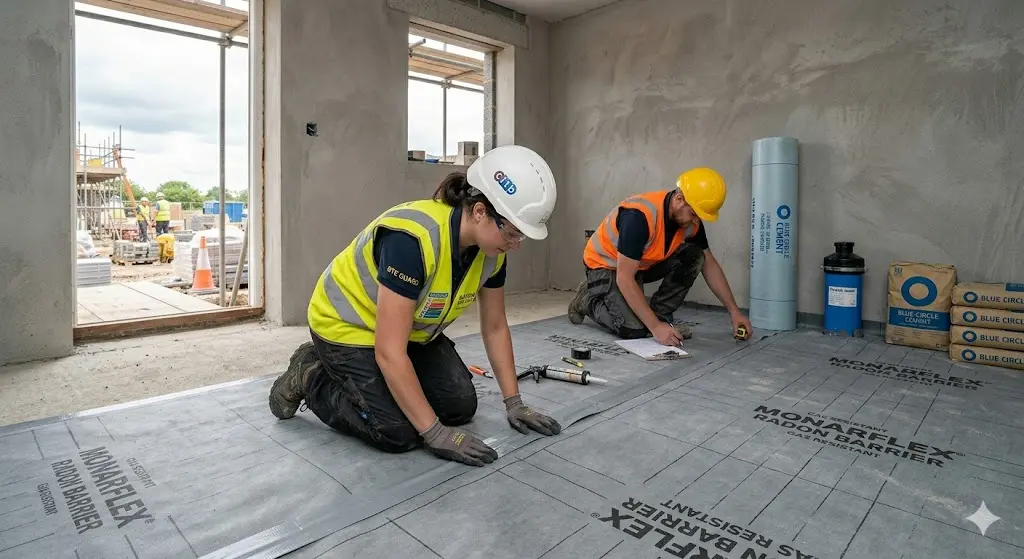
Classes 2 to 6 are all radon affected areas. Class 1 is not. For new build developments, classes 2 to 4 require basic protection, which is a continuous gas-resistant membrane across the full building footprint with correctly sealed joints and penetrations, plus provision for a future sump in classes 3 and 4. Classes 5 and 6 require full protection: the membrane plus an active radon sump system or fully ventilated sub-floor void installed as part of the original construction.
How to Check a Development Site on the UK Radon Map
There are two official routes for checking radon risk on a development site, and they are intended for different purposes. Knowing which one applies to your project is important.
For developments under 25 metres: ukradon.org address search
UKHSA operates an address-level search at ukradon.org. For a fee of £3.90 including VAT, you receive an instant PDF report confirming whether the specific address is in a radon affected area and the estimated probability that the property exceeds the 200 Bq/m3 action level. The report is delivered immediately online and also answers the CON29 legal enquiry question 3.13 on radon, which is required for property transactions in England and Wales.
| Important: the ukradon.org report is not for development sitesThe UKHSA address search at ukradon.org is designed for existing homes and small workplaces under 25 metres in length. UKHSA’s own guidance states: ‘If this site is for redevelopment, you should undertake a GeoReport provided by the British Geological Survey.’ Using the address search for a development site gives you useful indicative data but it is the BGS GeoReport that provides the formal risk data for building regulation purposes. |
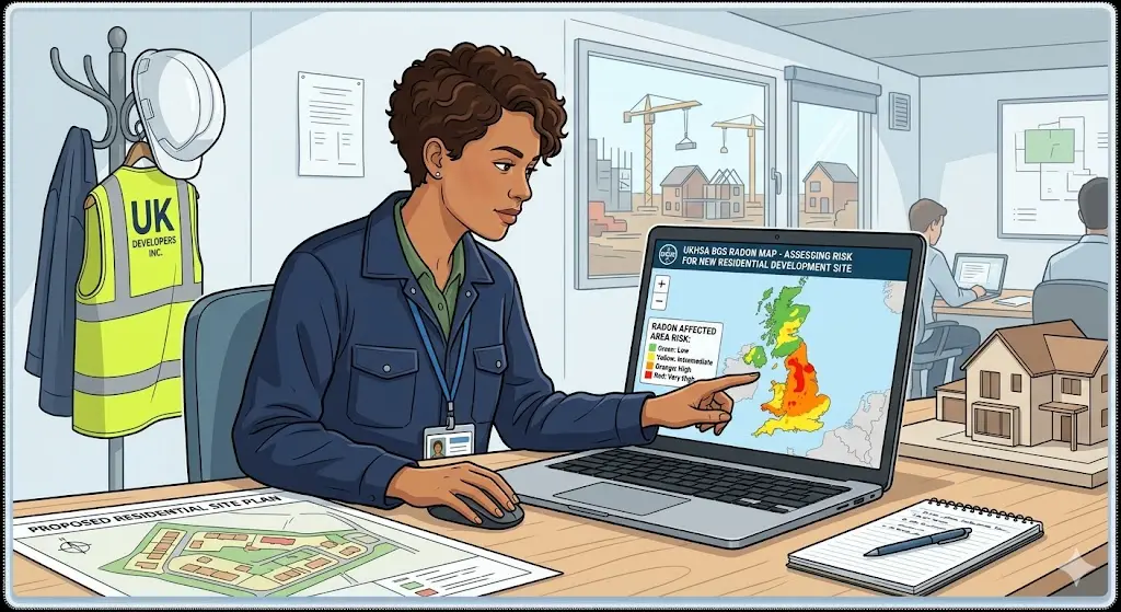
For development sites: BGS GeoReport
The British Geological Survey GeoReport service provides the definitive radon risk data for development sites. It uses the same underlying dataset as the UKHSA address search but is produced specifically for building regulation and planning purposes, and is the report that building control officers and local authority environmental health officers expect to see for new build projects in affected areas. The GeoReport confirms the radon risk class for the site, whether protective measures are required under Building Regulations, and what level of protection is needed under BR211 2023.
Free indicative check: BGS online viewer
BGS provides a free online GIS viewer and downloadable shapefiles of the full radon potential dataset for Great Britain under the Open Government Licence. This is useful for a quick initial desktop check before purchasing a report. The viewer shows radon risk at 25-metre resolution. It is not suitable for planning submissions but it will immediately tell you whether a site is in an affected area and approximately which class it falls into.
What the December 2022 Map Update Changed and Why It Still Matters
The December 2022 update to the Great Britain radon map was produced by UKHSA and BGS using three significant methodological improvements over the previous version, which had not been updated in England and Wales since 2007.
First, the measurement database grew substantially. BGS reduced the minimum number of indoor radon measurements required to classify a geological unit from 100 to 30, allowing smaller and more precisely bounded geological areas to be modelled individually rather than grouped with neighbouring geology.
Second, a 50-metre buffer zone that was previously applied around the edges of all high-risk areas was removed. This buffer existed to provide a safety margin around zone boundaries but had the effect of including properties that were not genuinely at elevated risk. Removing it made the map more precise and reduced false-positive classifications at zone edges.
Third, the updated map covers Scotland for the first time since 2011, using newer geological data from BGS to reclassify significant areas of the Scottish highlands, Aberdeenshire, and Derbyshire.
| The practical consequence for developers in 2026Any site assessment, planning application, or gas protection design based on the pre-December 2022 radon map may now be using outdated risk data. Some sites that were previously outside radon affected areas are now inside them. Some sites previously classified as lower risk have moved into higher classes. Developers with live projects or sites in the pre-application stage should reconfirm their radon classification against the current map before finalising the protection design. |
Which Parts of the UK Have the Highest Radon Risk?
The highest radon concentrations in the UK are strongly linked to underlying geology, specifically the presence of granite and uranium-bearing rock formations. The areas classified as Class 5 or Class 6 on the UK radon map, where more than 10% and more than 30% of properties respectively are estimated to exceed the action level, are predominantly:
- Cornwall and Devon, where granite geology creates the highest radon concentrations in England. Parts of West Cornwall have some of the highest recorded indoor radon levels in the UK.
- Derbyshire and parts of the East Midlands, including areas around the Peak District, where limestone and mineralised geology produce elevated radon levels.
- Northamptonshire, where ironstone geology contributes to higher than average radon levels across much of the county.
- Parts of Wales, particularly Gwynedd and Ceredigion, where ancient metamorphic and igneous rocks produce elevated radon.
- Aberdeenshire and parts of the Scottish Highlands, where granite batholiths create radon levels comparable to the South West of England.
- Somerset and parts of the Mendip Hills, where carboniferous limestone geology generates moderate to high radon concentrations.
It is worth noting that radon affected areas also exist in locations less commonly associated with high radon, including parts of the East Midlands, Lincolnshire, and Herefordshire. The December 2022 map update added several areas that were not previously classified as affected, so the geographic footprint of radon obligation is wider than many developers assume.
What Developers Must Do Once a Site Is Confirmed as Radon Affected
Finding that your development site is in a radon affected area does not mean the project cannot proceed. It means the building design must incorporate the appropriate level of radon protection under Approved Document C and BR211 2023. The steps are sequential and must happen in the right order.
Step 1: Get the correct report for your site
Use the BGS GeoReport for development and planning purposes, not the UKHSA address check. The GeoReport confirms the risk class and the Building Regulations requirement explicitly. Keep it on file as part of your planning and building control submissions.
Step 2: Have the protection level specified by a competent designer
The gas protection designer must incorporate the correct level of radon protection into the construction specification. For Classes 2 to 4, this is a continuous radon membrane with sealed joints and penetrations, plus a sealed sump connection point where required. For Classes 5 and 6, an active sump system or fully ventilated sub-floor void is required as part of the original build. The designer should complete the Radon Protective Measures Quality Management Record from Appendix B of BR211 2023.
Step 3: Appoint an independent verifier before installation begins
BR211 2023 specifically strengthened its references to third-party integrity testing and verification for radon protection systems. The same CIRIA C735 framework that governs ground gas membrane verification applies to radon membranes. An independent verifier must produce a Verification Implementation Plan before installation, attend site at inspection milestones, carry out air lance integrity testing of joints and penetrations, and produce a formal verification report for building control and planning authority submission.
For sites where radon risk overlaps with other ground gas risks such as methane or CO2, a single integrated verification covering all applicable protection elements is the most efficient route to compliance. Ground Gas Verification handles combined verifications across all gas types at groundgasverification.co.uk.
How We Help Developers in Radon Affected Areas Stay Compliant
The UK radon map now provides more accurate site-level data than at any point in the past fifteen years. With the December 2022 update extending the radon affected area designation to sites that were previously unaffected, and BR211 2023 tightening the verification and quality management requirements for new build protection systems, the risk of non-compliance is higher than developers who last dealt with a radon project before 2022 may realise.
At Ground Gas Verification, we verify radon protection membranes as part of the same independent process we apply to all gas protection installations. We appoint before installation begins, produce the Verification Implementation Plan, attend site at every required inspection milestone, test joints and penetrations using air lance methods, and deliver a formal verification report in the structure that building control and planning authorities accept. Where a site has both radon and ground gas risks, we provide a single combined verification covering all protection elements.
We work entirely independently of membrane manufacturers and installation contractors, with no commercial interest in any installation being declared compliant. Every report is produced by an accredited verifier whose independence can be demonstrated to any planning officer or building control officer who checks.
Frequently Asked Questions
What is a radon affected area?
A radon affected area is any location in the UK where 1% or more of properties are estimated to have indoor radon levels at or above the action level of 200 Bq/m3. The classification is based on the joint UKHSA and BGS radon potential dataset, last updated for Great Britain in December 2022. Being in a radon affected area triggers specific Building Regulations requirements for new build properties.
How do I check my UK development site postcode for radon risk?
For a quick indicative check, use the free BGS radon map viewer at bgs.ac.uk or the free downloadable shapefiles. For a formal report suitable for building regulation purposes, commission a BGS GeoReport for the development site. For a simple address check on an existing property under 25 metres, the UKHSA address search at ukradon.org costs £3.90 and provides an instant PDF. Developers should use the BGS GeoReport, not the UKHSA address search, for new build projects.
When was the UK radon map last updated?
The current radon potential map for Great Britain was published on 1 December 2022. It was the first update in England and Wales since 2007 and in Scotland since 2011. The Northern Ireland radon map was last updated in 2015 and was not part of the December 2022 update. Any risk classification based on an older map should be reconfirmed against the current data.
Does every new build in a radon affected area need a membrane?
Yes, for Classes 2 to 6. Class 2 to 4 require basic protection, which is a continuous radon-resistant membrane across the full building footprint with sealed joints and penetrations. Class 3 and 4 also require a sealed sump connection for potential future active extraction. Classes 5 and 6 require full protection with an active sump or ventilated sub-floor void installed as part of the original construction.
Does radon protection need to be independently verified?
Yes. BR211 2023 strengthened the requirement for third-party integrity testing and verification. The CIRIA C735 framework for gas membrane verification applies to radon protection membranes. An independent verifier must be appointed before installation, must attend site at inspection milestones, carry out air lance testing of joints and penetrations, and produce a verification report. The verifier must be independent of the installer and any material supplier.
Can radon protection be combined with ground gas membrane protection?
Yes. Where a site has both a ground gas risk such as methane or CO2 and a radon risk, the protection system must perform against all identified gases. The membrane must be specifically selected and justified to provide protection against each gas type present, including radon, which requires a lower gas diffusion rate than protection against methane alone. A single integrated verification covering all gas types is the most efficient route to compliance.
What happens if radon protection is not built into a new development?
Building control should identify the omission at plan check stage and refuse to issue completion certificates until the protection is incorporated. If the omission is discovered after construction, remediation requires installing a post-construction radon sump system through the floor slab, which is far more expensive and disruptive than designing it in from the outset. Developers are also exposed to liability if future occupants develop health problems attributable to elevated radon levels.